Les Chardons Bleus nature reserve (no. 17)
This circuit runs above the canyon of the Fournel and takes you to the Deslioures nature reserve, a Natura 2000 site established in 1993 by the French Forestry Commission. This area is home to one of Europe's biggest populations of blue sea holly (Eryngium alpinum) which is protected at national and European level. It is also called the Queen-of-the-Alps.
Description
The circuit starts right in the centre of town, not far from the bridge spanning the Durance. Head due south towards the train station.
- After passing the train station on your right and going under the railway bridge, follow the D423 towards the Fournel mines ("Mines du Fournel")
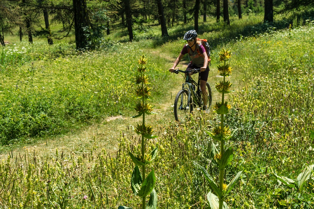
- At the mine car park, carry on along the narrow road leading into the little valleyn
- At a bridge, the Pont des Albrands, carry on along the forest track on the left-hand bank of the river
- When you come to the terminal point of the forest track, turn back on yourself and go back along the path
- Head right to cross the Fournel and reach Boujurian. Head towards the Pont d'Albrands and the Pont du Sapey
- At the Pont du Sapey, stay on the right-hand bank of the Fournel and start the descent to the district of Plan Léothaud
- At Plan Léothaud, go under the railway line. This brings you to the leisure centre and on to the end of the trail via the green route ("Voie Verte")
- Departure : Place du kiosque, L’Argentière-la-Bessée
- Arrival : Place du kiosque, L’Argentière-la-Bessée
- Towns crossed : L'Argentière-la-Bessée
Forecast
Altimetric profile
Sensitive areas
Golden eagle
- Impacted practices:
- Aerial, , Vertical
- Sensitivity periods:
- JanFebMarAprMayJunJulAug
- Contact:
- Parc National des Écrins
Julien Charron
julien.charron@ecrins-parcnational.fr
Golden eagle
- Impacted practices:
- Aerial, , Vertical
- Sensitivity periods:
- JanFebMarAprMayJunJulAug
- Contact:
- Parc National des Écrins
Julien Charron
julien.charron@ecrins-parcnational.fr
Short-toed snake eagle
- Impacted practices:
- Aerial,
- Sensitivity periods:
- MarAprMayJunJulAugSep
- Contact:
- Parc National des Écrins
Julien Charron
julien.charron@ecrins-parcnational.fr
Short-toed snake eagle
- Impacted practices:
- Aerial,
- Sensitivity periods:
- MarAprMayJunJulAugSep
- Contact:
- Parc National des Écrins
Julien Charron
julien.charron@ecrins-parcnational.fr
Short-toed snake eagle
- Impacted practices:
- Aerial,
- Sensitivity periods:
- MarAprMayJunJulAugSep
- Contact:
- Parc National des Écrins
Julien Charron
julien.charron@ecrins-parcnational.fr
Short-toed snake eagle
- Impacted practices:
- Aerial,
- Sensitivity periods:
- MarAprMayJunJulAugSep
- Contact:
- Parc National des Écrins
Julien Charron
julien.charron@ecrins-parcnational.fr
Recommandations
Rescue services contact details: Secours Montagne (Mountain Rescue): +33 (0)4 92 22 22 22 or 112
Take your litter home;
Do not take shortcuts across pastureland
Transport
Public transport >> www.pacamobilite.fr
Consider car-sharing >> www.blablacar.fr
For more information, ask at the Tourist Information Office nearest to the trail starting point >> www.paysdesecrins.com
Access and parking
16 km from Briançon, take the N94.
Parking :
Source

Report a problem or an error
If you have found an error on this page or if you have noticed any problems during your hike, please report them to us here: