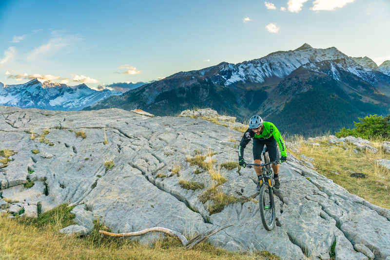
Les Grandes Têtes (no. 14)
You first have to go through the ski resort of Puy Saint-Vincent to reach the pastoral surroundings of the Tournoux plateau and on to the Col de la Pousterle. From here, set out on the panoramic tour of the peak of Les Têtes. An absolute joy!
Description
The route starts at the entrance to the « RECOUMERE » car park in the Puy Saint-Vincent 1800 resort near the Résidence Le Parc Aux Étoiles. It starts on the road, then straight on at the hairpin along a track above the buildings.
- Turn off this track onto another track leading left towards the Escapade chairlift ("Télésiège de l'Escapade") and the start of the summer toboggan run
- At the Chalet de Pré Loubet, turn right onto another track and after 200 metres, turn left which brings you to a sharp bend
- Take the narrow track on the left and then turn left again towards Le Laus. After this chalet, carry straight on, continue along the upper edge of the Tournoux plateau and on towards the Col de la Pousterle along a track which runs along the foot of a rock bar. It comes out on the plateau of the Col de la Pousterle
- Turn left and, after a short distance, right. The track leads away along a balcony route
- Turn right off the track towards the Lac des Sagnes
- As you approach the Lac des Sagnes, head left onto a track overlooking the Lac des Charbonnières and the Lac des Lauzes, which can be difficult to make out, and which comes out on the L'Argentière-la-Bessée side
- Drop back downhill to the Lac des Sagnes, and then turn left towards the Col de la Pousterle. This then brings you back to the plateau and Les Tournoux
- At Les Tournoux, head right onto a track which leads past some chalets and brings you back to Le Pré Loubet, and then on to your starting point
- Departure : Car park near the Résidence Le Parc Aux Étoiles at the 1800 resort, Puy Saint-Vincent
- Arrival : Car park near the Résidence Le Parc Aux Étoiles at the 1800 resort, Puy Saint-Vincent
- Towns crossed : Puy-Saint-Vincent, Les Vigneaux, and L'Argentière-la-Bessée
Forecast
Altimetric profile
Sensitive areas
Peregrine falcon
- Impacted practices:
- Aerial, Vertical
- Sensitivity periods:
- FebMarAprMayJun
- Contact:
- Parc National des Écrins
Julien Charron
julien.charron@ecrins-parcnational.fr
Recommandations
Rescue services contact details: Secours Montagne (Mountain Rescue): +33 (0)4 92 22 22 22 or 112
Show consideration for the work of farmers, livestock keepers and owners
Take your litter home
Do not take shortcuts across pastureland
Transport
Public transports >> www.pacamobilite.fr
Consider car-sharing >> www.blablacar.fr
For more information, ask at the Tourist Information Office nearest to the trail starting point >> www.paysdesecrins.com
Access and parking
14.7 km from L'Argentière-la-Bessée, take the D994E, D4 and D804.
Parking :
Source

Report a problem or an error
If you have found an error on this page or if you have noticed any problems during your hike, please report them to us here: