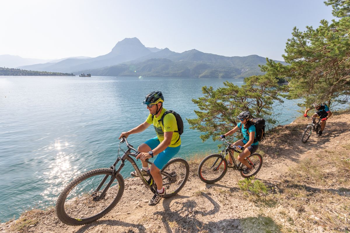
Lac de Serre-Ponçon 5-day Mountain Bike Tour
With stunning waters and the thrills of the mountain environment, and never straying far from the shoreline of Lac de Serre-Ponçon, this 5-day mountain bike tour will introduce you to unspoiled nature, deserted villages, a beautifully preserved historic abbey... And of course the monumental dam that has tamed the River Durance.
Description
From Embrun, the route rises rapidly into the dense forests of Boscodon. A halt at the Abbey is an opportunity to recharge your batteries mid-way up. A pretty descent down to Savines-le-Lac sets the tone for what is to come: this tour will be fun, technical at times and panoramic.
From Savines, a straightforward ascent leads to the belvedere of Pierre Arnoux. A succession of balcony paths lead down to the perched village of Pontis. You gradually leave the coolness of the beech forest behind to enter a more open landscape of terraces, old hamlets and a dolmen, yet with the magnificence of the lake always within eyesight. The final stretch of this second stage takes an unused railway line along the Ubaye: don't forget to take lamps for the tunnels!
The third stage is the least challenging but just as pretty, running through the plateaus and hills of Ubaye Serre-Ponçon and La Bréole. The trails leading to L'Escoubaye and its belvedere and the descent to the foot of the dam will take your breath away...
From this imposing dam, a long ascent takes you to an important World War Two Resistance monument, the Croix des Prés, before reaching "Le Ruban". The view from here is undoubtedly the finest on the route. It follows numerous technical descents down to the shores of the lake. Proceed with caution!
The final stretch from Chorges runs past a succession of bays and inlets, an ever-present temptation to take a swim, before heading uphill to Puy-Sanière. Brace yourself for the Descente des Tourniquets. This helter-skelter section is a must-ride for mountain bikers in the Embrunais area.
- Departure : Embrun
- Arrival : Embrun
- Towns crossed : Embrun, Baratier, Crots, Savines-le-Lac, Pontis, Le Lauzet-Ubaye, Ubaye-Serre-Ponçon, Rousset-Serre-Ponçon, Espinasses, Chorges, Prunières, Saint-Apollinaire, and Puy-Sanières
Forecast
Altimetric profile
Sensitive areas
Short-toed snake eagle
- Impacted practices:
- Aerial,
- Sensitivity periods:
- MarAprMayJunJulAugSep
- Contact:
- Parc National des Écrins
Julien Charron
julien.charron@ecrins-parcnational.fr
Short-toed snake eagle
- Impacted practices:
- Aerial,
- Sensitivity periods:
- MarAprMayJunJulAugSep
- Contact:
- Parc National des Écrins
Julien Charron
julien.charron@ecrins-parcnational.fr
Recommandations
Service your bike before you set off. Carry a derailleur hanger, pump, repair kit etc. In the interests of comfort, avoid carrying more than 5kg.
Book your accommodation in advance. There may be no vacancies on the day. According to your skill level, consider calling on the services of a trip organiser and a mountain biking instructor. They will simplify your organisation and make your trip so much more enjoyable, as well as saving you time.
Transport
Direct train lines : Paris/Briançon ou Marseille/Briançon
TGV to Grenoble, Valence, Aix en Provence.
Booking information and ticketing :
https://www.oui.sncf/
TER PACA (Provence Alpes Côte d'Azur) – Chorges railway station or Embrun railway station.
www.ter.sncf.com/paca
Access and parking
From Gap or Briançon, via the N94.
Parking :
Source

Report a problem or an error
If you have found an error on this page or if you have noticed any problems during your hike, please report them to us here: