Serre Renard
Chorges
Serre Renard
4h45
30,5km
+1489m
-1489m
Loop
Embed this item to access it offline
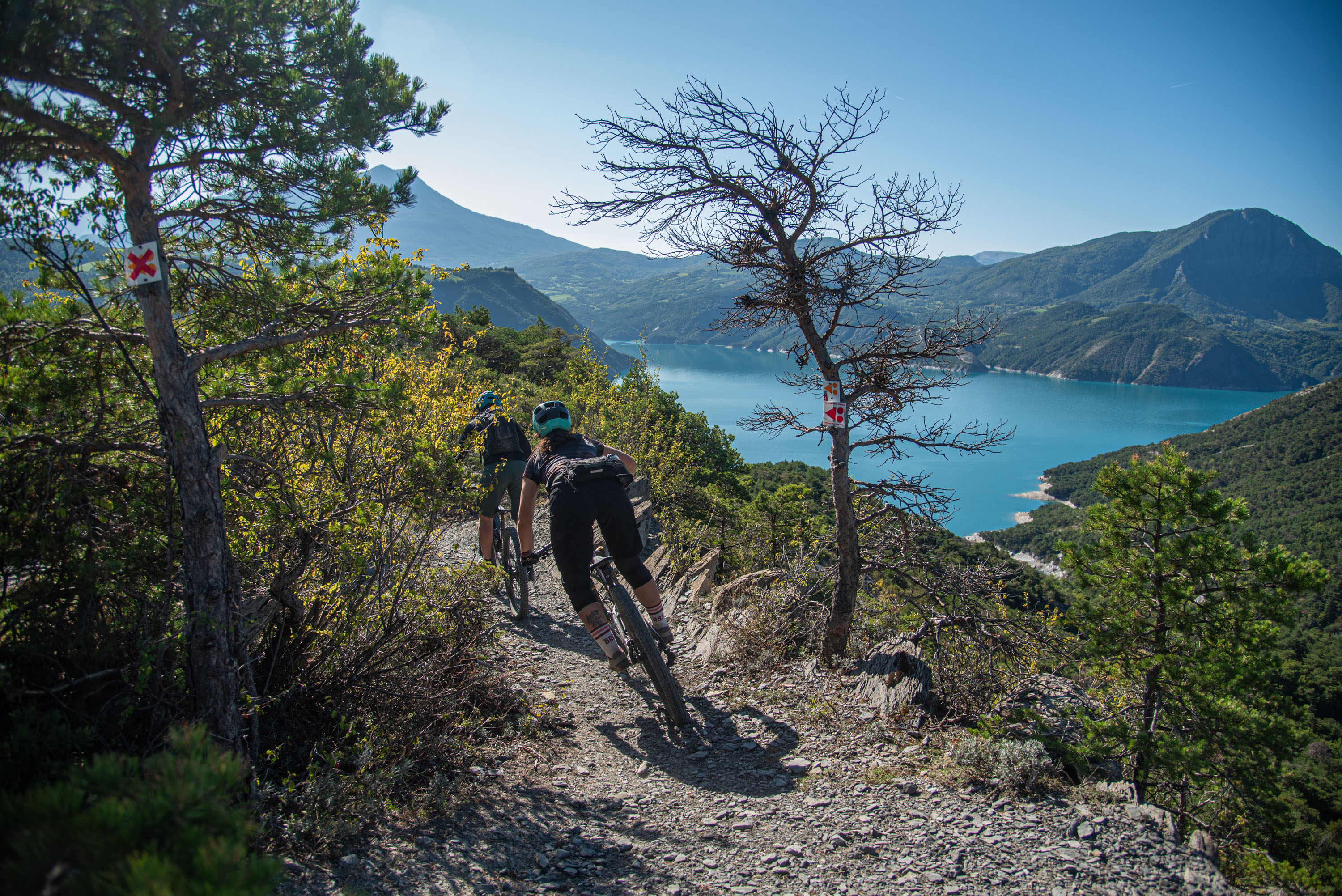
The route is a unique playground of technical ascents and descents, with a unique view of lake Serre-Ponçon, the dam and the Ubaye and Avance valleys. There are several picnic tables at the top of the route, where you can take a break and enjoy a snack.
Description
- From the SNCF station, head towards Intermarché, then take the level crossing and continue to the left, before the level crossing turn right towards "Le Fein".
- When the path descends again, turn right to reach "Les Olliviers". After passing the chapel, take a sharp left onto a wider road, continuing for over a kilometre before entering a single track on the left-hand side of the road.
- Turn right towards Col Lebraut, then after a few kilometres take a passable track to the right. Continue on the widest path and pass the "Champ du Comte" forest hut and the "Croix des Sept Frères".
- At the "Clot Clavary" hut take the middle path which alternates between ascents and descents as far as the lookout. Then take the path that winds up to Col Lebraut, where the path continues on the left for a short climb.
- Once you reach the last lookout, above the "Hyvans" continue straight on towards the dam. At "Hyvans" join the road that goes up to the left.
- After a few kilometres on the road, leave it to join a path that heads deep into the forest. Take the second road for a few metres to cross it, then continue on the footpath.
- Join the road on the right, then follow it in the direction of "Chorges". When you reach the "Les Horizons du lac" hotel, leave the main road and head towards "Villard". Take the path ascending to the left and cross all the fields and the railway line.
- Reach the road on the left and continue straight on to the level crossing. After the level crossing, turn right and follow the original route in the opposite direction.
- Departure : Chorges
- Arrival : Chorges
- Towns crossed : Chorges, Montgardin, Espinasses, and Rousset-Serre-Ponçon
Forecast
Altimetric profile
Recommandations
La descente en surplomb du lac nécessite de bonnes capacités techniques en VTT.
Transport
Public transport : ccserreponcon.com
Access and parking
Follow the N94 from Gap or Embrun to Chorges.
Parking :
Station car park, Chorges
Source

Serre-Ponçonhttps://www.serreponcon.com
Report a problem or an error
If you have found an error on this page or if you have noticed any problems during your hike, please report them to us here: