Loop 55 - Lac du Siguret
Saint-André-d'Embrun
Loop 55 - Lac du Siguret
1h15
13,3km
+640m
-641m
Loop
Embed this item to access it offline
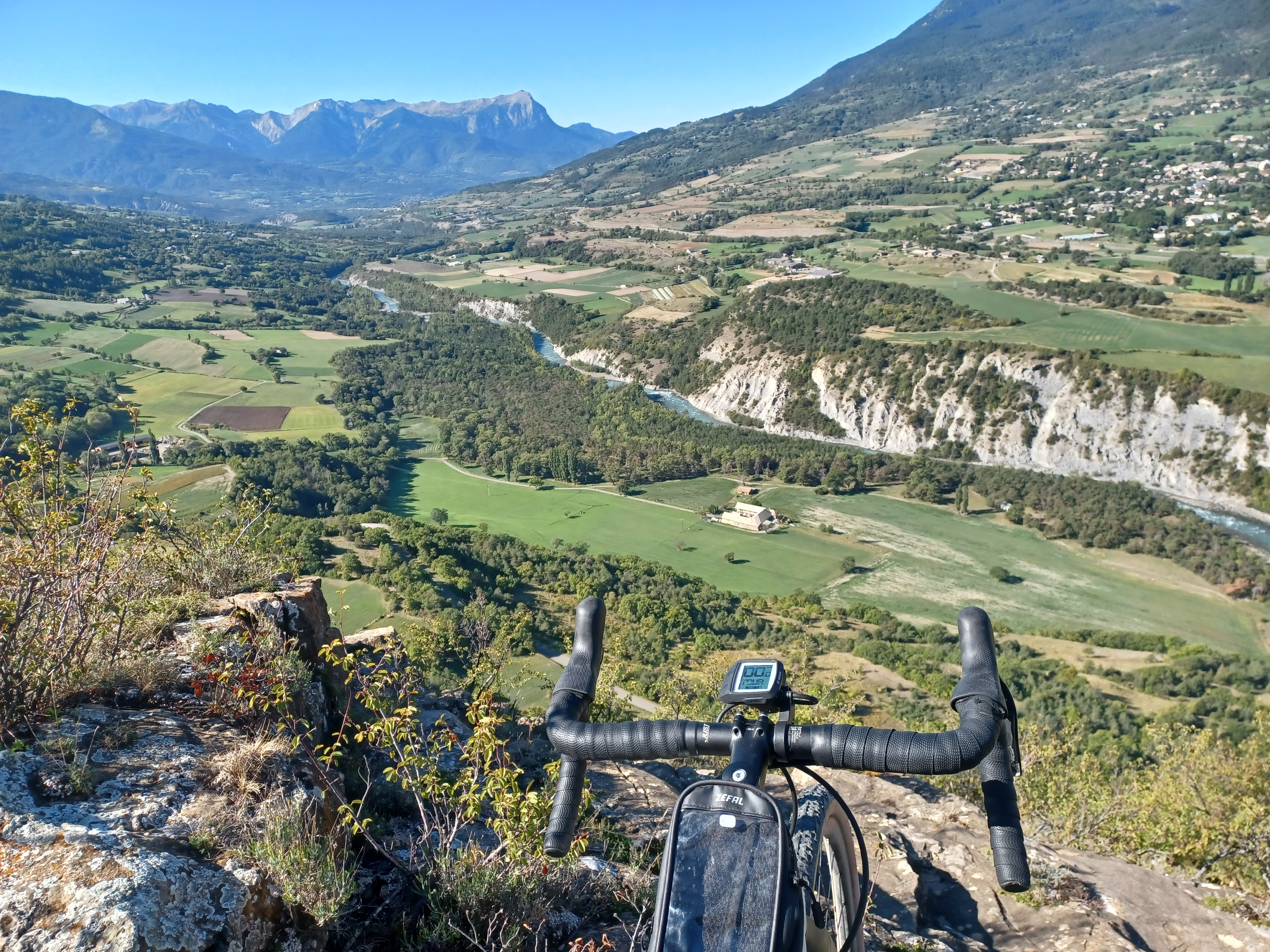
Lac du Siguret is a pleasant little Gravel trail. Initially shaded by conifers, the landscape then opens out onto a welcoming plateau, the lake and Chapelle Saint-Roch. The rolling return journey takes in an old road and farm tracks overlooking the Durance.
Description
- At the school in Saint-André d'Embrun, turn right at the washhouse and go up the Chemin de Clotinard. At the road, turn right and then left onto the forest road (DFCI track H33).
- On the straight stretch, descend the path on the left and at the crow's feet intersection, take the ascend on the left. Follow a discreet path opposite and continue straight ahead (/!\ wetland and stones).
- At the water tank, descend to the right. At the bend, turn right up the road and continue straight ahead on the track to reach Lac de Siguret.
- At the lake, turn left twice and then right to reach a crossroads of 4 paths: continue straight down the stony path /!\. Continue left along the edge of the field and forest.
- Take the slightly uphill road to the left. (D994D).
- At the entrance to the village of Siguret, descend once to the right and again at the fountain to join a path.
- At the end of the path, turn right then left up a small road.
- At the road (D994D), turn right to cross the hamlet of "La Place". Stay on this road.
- At the D139, turn left twice in the direction of the county town until you reach the arrival point.
- Departure : Saint-André-d'Embrun
- Arrival : Saint-André-d'Embrun
- Towns crossed : Saint-André-d'Embrun
Forecast
Altimetric profile
Sensitive areas
Along your trek, you will go through sensitive areas related to the presence of a specific species or environment. In these areas, an appropriate behaviour allows to contribute to their preservation. For detailed information, specific forms are accessible for each area.
Short-toed snake eagle
- Impacted practices:
- Aerial,
- Sensitivity periods:
- MarAprMayJunJulAugSep
- Contact:
- Parc National des Écrins
Julien Charron
julien.charron@ecrins-parcnational.fr
Recommandations
Avant de partir vérifiez l’état de votre vélo, surveillez la météo et équipez vous selon la saison et la durée de votre randonnée.
Vous évoluez en zone de montagne, privilégiez des pneus de Gravel large, des freins à disque hydraulique et maitrisez votre vitesse.
Prudence dans la descente du Hameau de Vière et pour rejoindre la vallée de la Durance.
Pour plus de confort faites appel à un moniteur de cyclisme
Secours : 112
Vous évoluez en zone de montagne, privilégiez des pneus de Gravel large, des freins à disque hydraulique et maitrisez votre vitesse.
Prudence dans la descente du Hameau de Vière et pour rejoindre la vallée de la Durance.
Pour plus de confort faites appel à un moniteur de cyclisme
Secours : 112
Transport
SNCF: Chorges station, Embrun https://www.sncf-connect.com/
Bus : Valserres, La Bâtie Neuve, Chorges, Puy Saint Eusèbe, Puy Sanières, Embrun Baratier, Les Orres, Remollon, Theus, Espinasse
Marseille-Briançon : (LER29)
Marseille, Nice : Lignes Express Régionales (LER) +33 (0)809 400 415
Grenoble : Transisère +33 (0)4 26 16 38 38
Gap-Barcelonnette (LER535)
Carpooling area : Rond point des Orres - 05200 Baratier
Plane:
Marseille Provence Airport (188km) - +33 (0)820 811 414
Grenoble Alpes Isère Airport (158km) - +33 (0)4 76 65 48 48
Lyon Saint Exupéry Airport - (203km) +33 (0)826 800 826
Turin Caselle Airport - (178km) + 39 011 567 63 74
Access and parking
From Grenoble, Lyon, Paris : RN 85 or RN 75. At Gap on the RN 94 towards Briançon.
Parking :
Place de la Mairie car park, Saint-André-les-Alpes
Source

Serre-Ponçonhttps://www.serreponcon.com
Report a problem or an error
If you have found an error on this page or if you have noticed any problems during your hike, please report them to us here: