Loop 51 - Les Pins
Puy-Saint-Eusèbe
Loop 51 - Les Pins
1h15
13,6km
+564m
-564m
Loop
Embed this item to access it offline
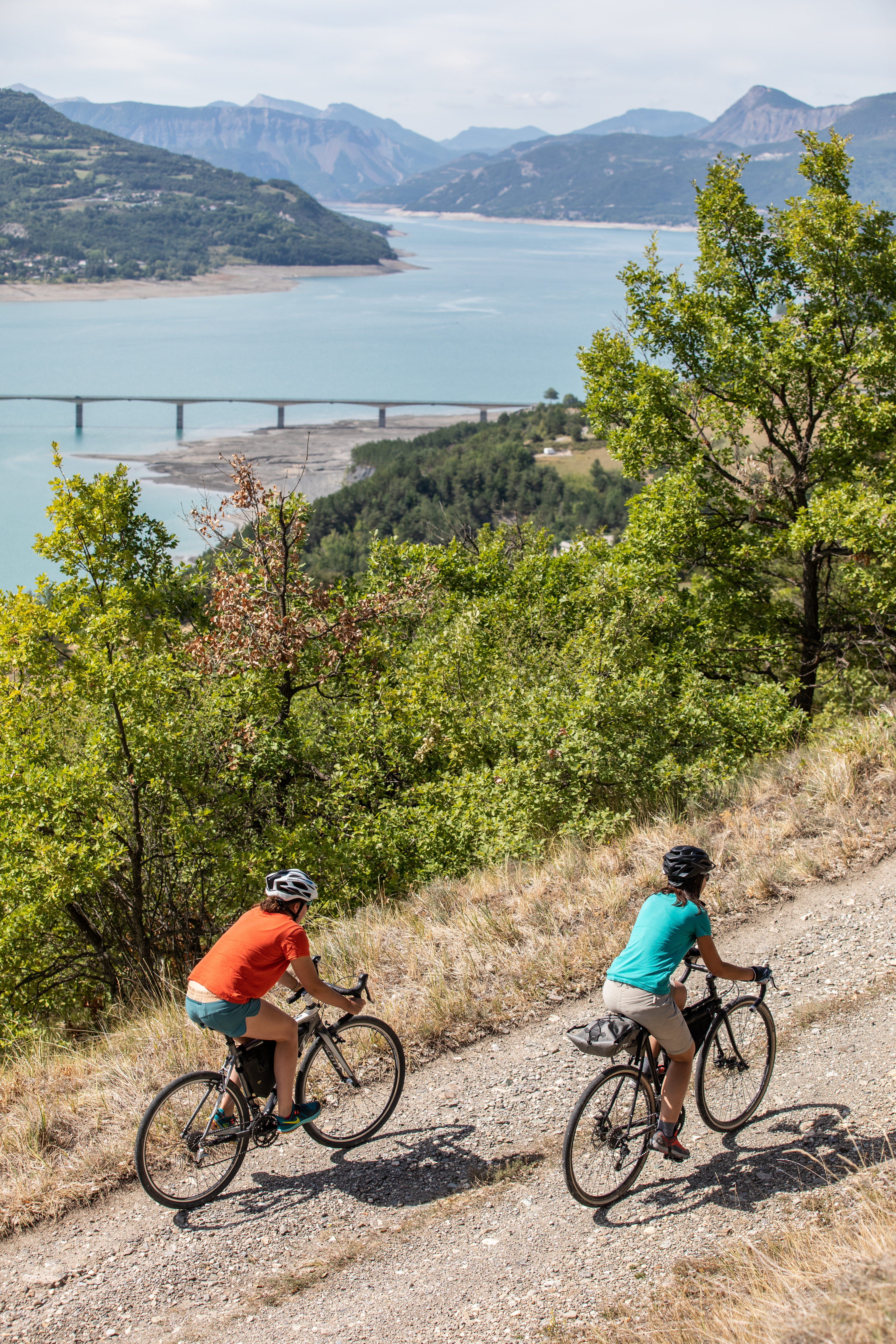
A short but demanding loop!
A particularly uncomfortable first descent, but it's only temporary. The rest of the route will be more gentle. It passes through forests, hamlets and farmland. This south-facing slope used to be home to vineyards: the sheds used to store tools can still be seen today.
A particularly uncomfortable first descent, but it's only temporary. The rest of the route will be more gentle. It passes through forests, hamlets and farmland. This south-facing slope used to be home to vineyards: the sheds used to store tools can still be seen today.
Description
- From the sign indicating the start of the mountain bike circuits, head up the road and once you reach the school continue straight ahead on the D741.
- At Chemin du Bouis, descend to the right. /!\ Some stony stretches. Stay on the winding downhill track as far as the water treatment plant.
- Skirt the water treatment plant on the left and continue downhill towards 2 streams. /!\ Be careful, the slope is steep before the streams.
- Just after the house, descend down to the right on the less marked path (in the axis of le Morgon)*. /!\ occasionally exposed area. At the road (D741) turn right. At the D641 turn left towards Puy Sanière. *(You can avoid this narrow path by staying on it and turning right onto the D741.
- Leave the road for the G35 DFCI track descending on the right. (Please close the gate after passing). At the bottom of the path, take the options on the left (Tour de Serre-Ponçon markings) and join the G38 DFCI track.
- Follow the G38 DFCI track to the right. Reach the Pibou Lookout by choosing the uphill options on the left of the main trail.
- At the Pibou lookout, continue on the track to the right. At the Route du Pibou, turn right towards Puy Sanière (D841).
- At the electrical substation, take a hairpin left onto the uphill track. At the hamlet of Pibou Bas, turn right up the route de Loupas. Before the right-hand bend (viewpoint of the Aiguilles de Chabrières), turn left onto the track. Stay on the main downhill track as far as the hamlet of Les Pins.
- At the hamlet of Les Pins descend n to the right (fountain). At rue de la Baume, continue along the road to the left to reach the finishing point.
- Departure : Le Villard, Puy St Eusèbe
- Arrival : Le Villard, Puy St Eusèbe
- Towns crossed : Puy-Saint-Eusèbe, Savines-le-Lac, and Puy-Sanières
Forecast
Altimetric profile
Sensitive areas
Along your trek, you will go through sensitive areas related to the presence of a specific species or environment. In these areas, an appropriate behaviour allows to contribute to their preservation. For detailed information, specific forms are accessible for each area.
Short-toed snake eagle
- Impacted practices:
- Aerial,
- Sensitivity periods:
- MarAprMayJunJulAugSep
- Contact:
- Parc National des Écrins
Julien Charron
julien.charron@ecrins-parcnational.fr
Recommandations
Avant de partir vérifiez l’état de votre vélo, surveillez la météo et équipez vous selon la saison et la durée de votre randonnée.
Vous évoluez en zone de montagne, privilégiez des pneus de Gravel large, des freins à disque hydraulique et maitrisez votre vitesse.
Prudence dans la descente du Hameau de Vière et pour rejoindre la vallée de la Durance.
Pour plus de confort faites appel à un moniteur de cyclisme
Secours : 112
Vous évoluez en zone de montagne, privilégiez des pneus de Gravel large, des freins à disque hydraulique et maitrisez votre vitesse.
Prudence dans la descente du Hameau de Vière et pour rejoindre la vallée de la Durance.
Pour plus de confort faites appel à un moniteur de cyclisme
Secours : 112
Transport
SNCF: Chorges station, Embrun https://www.sncf-connect.com/
Bus : Valserres, La Bâtie Neuve, Chorges, Puy Saint Eusèbe, Puy Sanières, Embrun Baratier, Les Orres, Remollon, Theus, Espinasse
Marseille-Briançon : (LER29)
Marseille, Nice : Lignes Express Régionales (LER) +33 (0)809 400 415
Grenoble : Transisère +33 (0)4 26 16 38 38
Gap-Barcelonnette (LER535)
Carpooling area : Rond point des Orres - 05200 Baratier
Plane:
Marseille Provence Airport (188km) - +33 (0)820 811 414
Grenoble Alpes Isère Airport (158km) - +33 (0)4 76 65 48 48
Lyon Saint Exupéry Airport - (203km) +33 (0)826 800 826
Turin Caselle Airport - (178km) + 39 011 567 63 70
Access and parking
From Grenoble, Lyon, Paris : RN 85 or RN 75. At Gap, take the RN 94 towards Briançon.
From Marseille, Montpellier A51 to La Saulce, continue towards Tallard (D942) and Briançon (RN 94).
From Marseille, Montpellier A51 to La Saulce, continue towards Tallard (D942) and Briançon (RN 94).
Parking :
Le Villard near the town hall, Puy Saint Eusèbe
Source

Serre-Ponçonhttps://www.serreponcon.com
Report a problem or an error
If you have found an error on this page or if you have noticed any problems during your hike, please report them to us here: