Loop 49 - Clos Besson and Lake St Apollinaire
Réallon
Loop 49 - Clos Besson and Lake St Apollinaire
1h45
24,1km
+1165m
-1166m
Loop
Embed this item to access it offline
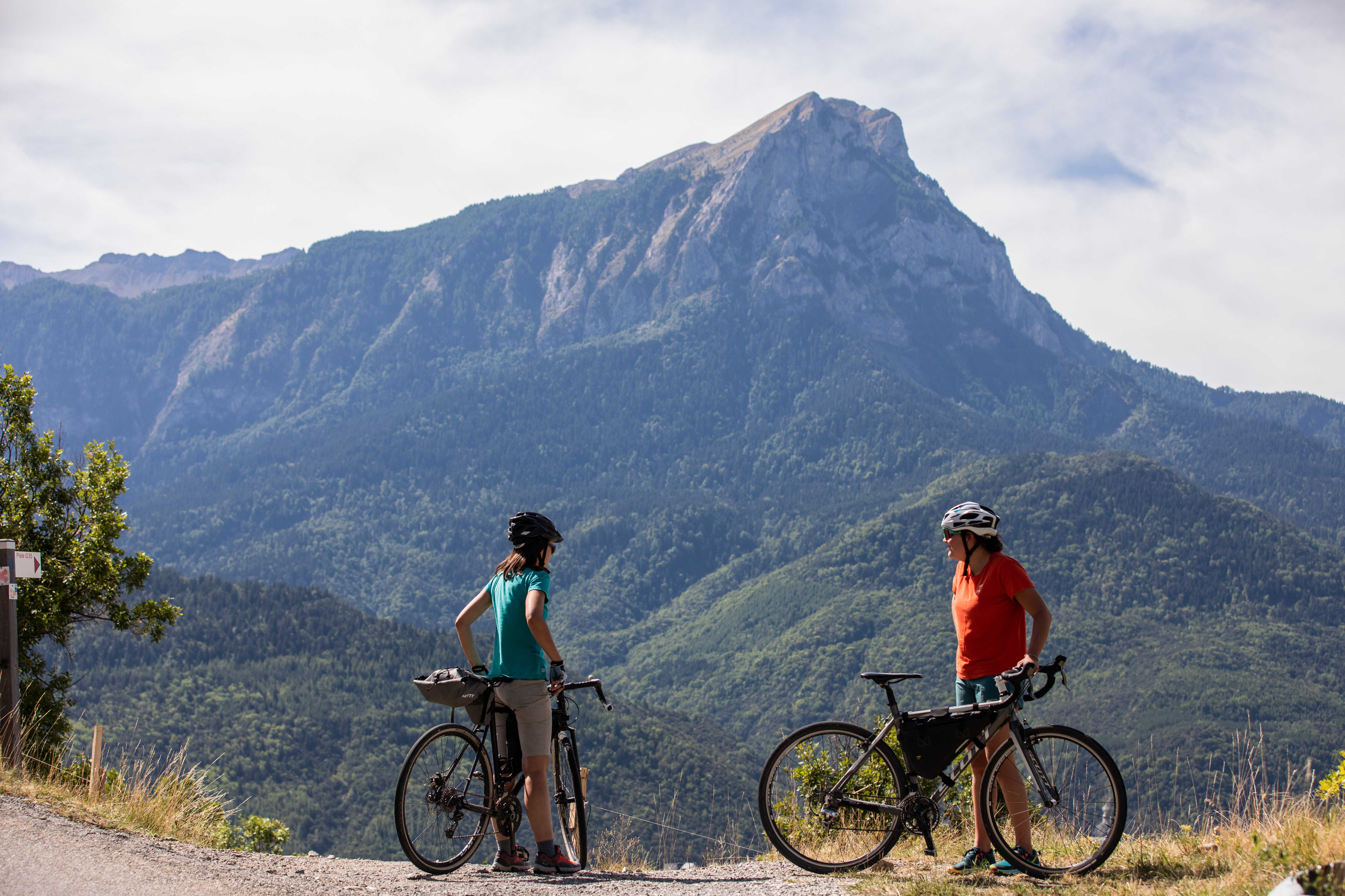
A Gravel course with 2 facets:
Along the lake, the landscape is open to the lake and its south-facing aspect creates a pre-Alpine atmosphere.
In the Réallon valley, wedged between the Aiguilles de Chabrières and Mont Guillaume, the stream is pleasantly cooling in summer and creates a more mountainous atmosphere.
Along the lake, the landscape is open to the lake and its south-facing aspect creates a pre-Alpine atmosphere.
In the Réallon valley, wedged between the Aiguilles de Chabrières and Mont Guillaume, the stream is pleasantly cooling in summer and creates a more mountainous atmosphere.
Description
- From the start of the route at the resort of Réallon, descend to the car park and up the track to the right (route forestière de Joubelle). Just before the turning, turn left down the forest track towards the village of Saint-Apollinaire.
- At the balcony path, (viewpoint over the lake) go up the path to the left (Possibility of making a return trip to Lake Saint-Apollinaire by taking two right turns). After a very steep but relatively short section, continue left on the path towards the resort of Réallon.
- At the road, descend to the right (D609). At a hairpin bend, take the stony track on the left. Turn right at the track. At Les Praux, follow the track to the left. Continue on the main track to the right towards Réallon camp-site.
- Continue straight ahead on the path that rises slightly towards Réallon. Take the Villard bridge and continue along the track on the left bank of the stream. At the crow's feet intersection, continue to the right.
- At the road, turn left towards the Isle leisure centre. Before the Cure bridge, turn right onto the road on the left bank of the stream. After the tennis courts, go straight ahead on the chemin de digue, then take the path on the left.
- At the water extraction point, WC and car park, take the bridge on the left that leads to Les Gourniers. At the Mélézin restaurant, turn left towards "Le Bourget". At Les Tomelles, the road becomes a path.
- At Le Bourget, continue straight on. At Les Granges, continue straight on towards the camp-site via Les Casses. At Les Casses, take the track on the right towards Les Mallets.
- At Les Mallets, take the second right towards the resort of Réallon. At Pra Prunier, continue straight on towards the resort. When you reach the bend in the D609 road, turn right towards the resort. At the entrance to the resort, turn left into the car park.
- Departure : The resort of Réallon
- Arrival : The resort of Réallon
- Towns crossed : Réallon, Savines-le-Lac, and Saint-Apollinaire
Forecast
Altimetric profile
Recommandations
Avant de partir vérifiez l’état de votre vélo, surveillez la météo et équipez vous selon la saison et la durée de votre randonnée.
Vous évoluez en zone de montagne, privilégiez des pneus de Gravel large, des freins à disque hydraulique et maitrisez votre vitesse.
Prudence dans la descente du Hameau de Vière et pour rejoindre la vallée de la Durance.
Pour plus de confort faites appel à un moniteur de cyclisme
Secours : 112
Vous évoluez en zone de montagne, privilégiez des pneus de Gravel large, des freins à disque hydraulique et maitrisez votre vitesse.
Prudence dans la descente du Hameau de Vière et pour rejoindre la vallée de la Durance.
Pour plus de confort faites appel à un moniteur de cyclisme
Secours : 112
Transport
SNCF: Chorges station, Embrun https://www.sncf-connect.com/
Bus : Valserres, La Bâtie Neuve, Chorges, Puy Saint Eusèbe, Puy Sanières, Embrun Baratier, Les Orres, Remollon, Theus, Espinasse
Marseille-Briançon : (LER29)
Marseille, Nice : Lignes Express Régionales (LER) +33 (0)809 400 415
Grenoble : Transisère +33 (0)4 26 16 38 38
Gap-Barcelonnette (LER535)
Carpooling area : Rond point des Orres - 05200 Baratier
Plane:
Marseille Provence Airport (188km) - +33 (0)820 811 414
Grenoble Alpes Isère Airport (158km) - +33 (0)4 76 65 48 48
Lyon Saint Exupéry Airport - (203km) +33 (0)826 800 826
Turin Caselle Airport - (178km) + 39 011 567 63 68
Access and parking
From Marseille, Montpellier A51 to La Saulce, continue towards Tallard (D942) and Briançon (RN 94).
Parking :
Réallon resort car park, Réallon
Source

Serre-Ponçonhttps://www.serreponcon.com
Report a problem or an error
If you have found an error on this page or if you have noticed any problems during your hike, please report them to us here: