VTT N°1 - Templar and Hospitaller Larzac
L'Hospitalet-du-Larzac
VTT N°1 - Templar and Hospitaller Larzac
3h
23,3km
+577m
-577m
Loop
Embed this item to access it offline
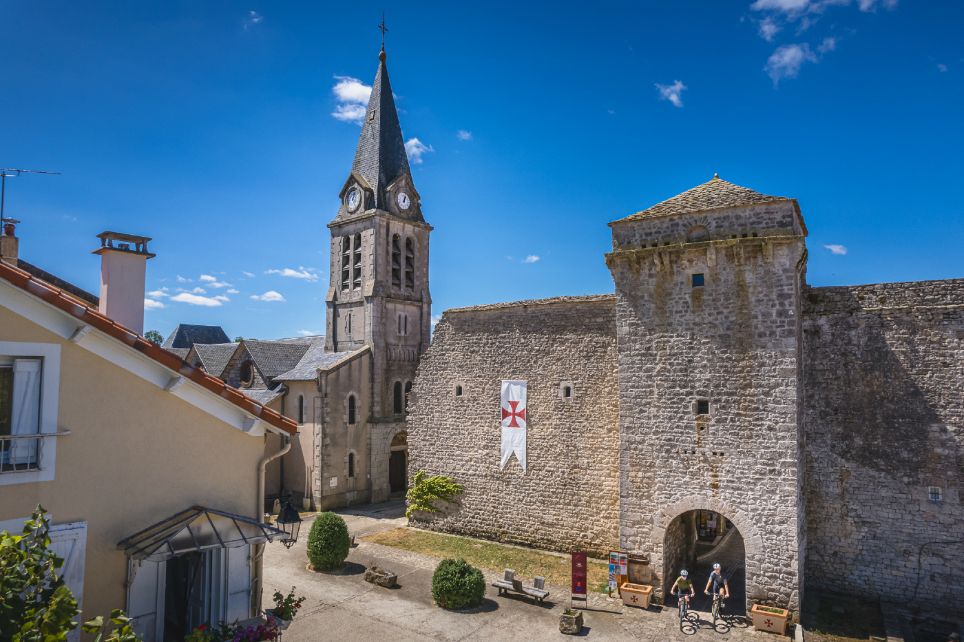
Almost 300m of vertical drop, a arduous climb, landscapes of the causses and wooded areas: along single-track paths, trails and alleys, explore the Larzac, its foothills, and the banks of the Cernon river. L'Hospitalet du Larzac, La Cavalerie and Sainte-Eulalie du Cernon are the three stopping places of this original route between causse and valley.
Description
- From the “Place des Cygnes”, follow the road towards Viala-du-Pas-de-Jaux on 2,5km
- Go up on the right track. Continue straight until joining again the road D277. Cross the road and take the path that flows in front on the left.
- After 300m down, take the path to the left. Before the road, follow the single path on the right. Warning, at the crossroads at the bottom of the hill, go straight ahead on the track. After the farm, continue straight towards “Espace Nature Ladoux” (Nature area), then take the right path along the stream.
- Then follow the road to Sainte-Eulalie, enter into the ramparts through the main gate and join the square (information center and toilet). Take the covered lane then the street on the left until the road to Lapanouse de Cernon.
- At the exit of the village, follow “Le Mas de Roque” on the right. After “Le Frayssinet”, continue the ascent to the plateau. Once on the heights continue straight towards La Cavalerie. (At the end of the hill, you can access to a viewpoint taking the track on the right for 1km towards the relay).
- At the Townhall, take right the road “Route de la Tune” towards the stadium, then at the crossroads take straight.
- 100m after the stadium, turn right on a track to pass under the road, then the motorway. Join the pine woods towards L’Hospitalet-du-Larzac.
- After the downhill, take the road on the right at the crossroads.
- Departure : L'Hospitalet du Larzac
- Arrival : L'Hospitalet du Larzac
- Towns crossed : L'Hospitalet-du-Larzac, Sainte-Eulalie-de-Cernon, and La Cavalerie
Forecast
Altimetric profile
Transport
Access and parking
25km at the south of Millau via D809. Exit 47 on the motorway A75.
Parking :
Place des Cygnes
Accessibility
- Emergency number :
- 114


Report a problem or an error
If you have found an error on this page or if you have noticed any problems during your hike, please report them to us here: